Uber Exif Photo
ExifTool Version Number :
12.50
File Size :
0 bytes
File Modification Date/Time :
2025:08:20 07:40:04+00:00
File Access Date/Time :
2025:08:20 07:40:04+00:00
File Inode Change Date/Time :
2025:08:20 07:40:04+00:00
File Permissions :
prw-------
File Type :
JPEG
File Type Extension :
jpg
MIME Type :
image/jpeg
JFIF Version :
1.01
X Resolution :
240
Displayed Units X :
inches
Y Resolution :
240
Displayed Units Y :
inches
Current IPTC Digest :
577c77323a9ee79a2df9b692ef0d82b8
Application Record Version :
2
Object Name :
En groupe
Keywords :
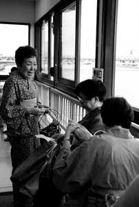
1- Au rythme des tokyoites, Book Tokyo, Export, FlickR, FlickR_Street, Japon, Leica, Pays, Scènes de vie, Tokyo, Ville
By-line :
Valérie LANDE
City :
Tokyo
Sub-location :
Sumida Gawa
Province-State :
Kanto
Country-Primary Location Code :
JPN
Country-Primary Location Name :
Japon
Headline :
Simplicité
Copyright Notice :
Artwo
Caption-Abstract :
Tokyo 2008
Copyright Flag :
True
Photoshop Thumbnail :
(Binary data 13460 bytes, use -b option to extract)
IPTC Digest :
577c77323a9ee79a2df9b692ef0d82b8
Exif Byte Order :
Little-endian (Intel, II)
Image Description :
Tokyo 2008
Make :
Leica Camera AG
Camera Model Name :
M8 Digital Camera
Resolution Unit :
inches
Software :
1.201; post-processed by CornerFix 0.9.1.9
Modify Date :
2010:10:17 10:50:01
Copyright :
Artwo
Exposure Time :
1/500
F Number :
2.0
Exposure Program :
Aperture-priority AE
ISO :
160
Sensitivity Type :
Unknown
Exif Version :
0220
Date/Time Original :
2008:08:06 16:32:31
Create Date :
2008:08:06 16:32:31
Shutter Speed Value :
1/500
Aperture Value :
2.0
Exposure Compensation :
-0.332
Max Aperture Value :
1.0
Metering Mode :
Center-weighted average
Light Source :
Unknown
Flash :
Auto, Did not fire
Focal Plane X Resolution :
3729
Focal Plane Y Resolution :
3764
Focal Plane Resolution Unit :
inches
File Source :
Digital Camera
Scene Type :
Directly photographed
White Balance :
Auto
Digital Zoom Ratio :
0
Scene Capture Type :
Standard
Image Unique ID :
00000000000000000000000000000445
Serial Number :
3195845
Lens Model :
Uncoded/Not detected
GPS Version ID :
2.2.0.0
GPS Latitude Ref :
North
GPS Longitude Ref :
East
GPS Altitude Ref :
Above Sea Level
GPS Time Stamp :
07:32:31
GPS Satellites :
0
GPS Map Datum :
WGS-84
GPS Date Stamp :
2008:08:06
Compression :
JPEG (old-style)
Thumbnail Offset :
15020
Thumbnail Length :
13460
Image Width :
202
Image Height :
300
Encoding Process :
Progressive DCT, Huffman coding
Bits Per Sample :
8
Color Components :
1
Aperture :
2.0
Image Size :
202x300
Megapixels :
0.061
Scale Factor To 35 mm Equivalent:
17.7
Shutter Speed :
1/500
Thumbnail Image :
(Binary data 13460 bytes, use -b option to extract)
GPS Altitude :
65.5 m Above Sea Level
GPS Date/Time :
2008:08:06 07:32:31Z
GPS Latitude :
35 deg 42' 38.10" N
GPS Longitude :
139 deg 47' 55.61" E
Circle Of Confusion :
0.002 mm
GPS Position :
35 deg 42' 38.10" N, 139 deg 47' 55.61" E
Light Value :
10.3